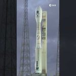
Our Biomass satellite has successfully launched, marking a major leap forward in understanding Earth’s forests and their vital role in the carbon cycle.
It lifted off on 29 April 2025 from Europe’s Spaceport in French Guiana aboard Vega-C, and is already sending back its first signals. Over the next few days, our mission controllers will carefully deploy Biomass’ enormous 12-metre-wide reflector – the key to its unique abilities.
📹 European Space Agency (ESA) 📸 ESA/CNES/Arianespace
ESA’s state-of-the-art Biomass mission is designed to provide new insights into the health and evolution of the world’s forests, helping us understand how they are changing over time and, importantly, their critical role in the global carbon cycle. Equipped with the first-ever fully polarimetric P-band synthetic aperture radar, this satellite can penetrate dense forest canopies. The long 70 cm wavelength of the radar enables it to measure ‘biomass’—the woody trunks, branches and stems—where trees store the majority of their carbon.
Credits: European Space Agency (ESA)
★ Subscribe: http://bit.ly/ESAsubscribe and click twice on the bell button to receive our notifications.
We are Europe’s gateway to space. Our mission is to shape the development of Europe’s space capability and ensure that investment in space continues to deliver benefits to the citizens of Europe and the world. Check out https://www.esa.int/ to get up to speed on everything space related.
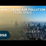
Air pollution is the largest environmental health risk in Europe and significantly impacts the health of the European population, particularly in urban areas.
Following on from the Sentinel-5P satellite – the first Copernicus mission dedicated to monitoring our atmosphere – the Sentinel-4 and Sentinel-5 missions will take current air quality measuring capabilities to the next level.
Together, the Sentinel-4 and -5 missions will provide information on atmospheric variables in support of European policies. This will include the monitoring of air quality, stratospheric ozone and solar radiation, and climate monitoring.
This video features interviews with Giorgio Bagnasco, Sentinel-4 Mission Project Manager, Ben Veilhelmann, Sentinel-4&5 Mission Scientist and Didier Martin, Sentinel-5 Mission Project Manager.
Credits: ESA – European Space Agency
★ Subscribe: http://bit.ly/ESAsubscribe and click twice on the bell button to receive our notifications.
We are Europe’s gateway to space. Our mission is to shape the development of Europe’s space capability and ensure that investment in space continues to deliver benefits to the citizens of Europe and the world. Check out https://www.esa.int/ to get up to speed on everything space related.
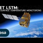
Climate change exacerbates droughts by making them more frequent, longer, and more severe. This can have a wide range of impacts on the environment, agriculture, ecosystems and communities including water scarcity, crop failure and food shortages.
The upcoming Copernicus Land Surface Temperature Monitoring, LSTM, mission will improve sustainable agricultural productivity in a world of increasing water scarcity and variability.
The mission will carry a high spatial-temporal resolution thermal infrared sensor to provide observations of land-surface temperature.
These data are key to understand and respond to climate variability, manage water resources for agricultural production, predict droughts and also to address land degradation.
LSTM is one of six Copernicus Sentinel Expansion missions that ESA is developing on behalf of the EU. The missions will expand the current capabilities of the Copernicus Space Component – the world’s biggest supplier of Earth observation data.
This video features interviews with Ana Bolea Alamanac, LSTM Mission Project Manager, Ilias Manolis, LSTM Mission Payload Manager and Itziar Barat, LSTM Mission System and Operations Manager.
Credits: ESA – European Space Agency
★ Subscribe: http://bit.ly/ESAsubscribe and click twice on the bell button to receive our notifications.
We are Europe’s gateway to space. Our mission is to shape the development of Europe’s space capability and ensure that investment in space continues to deliver benefits to the citizens of Europe and the world. Check out https://www.esa.int/ to get up to speed on everything space related.
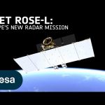
The upcoming Copernicus Radar Observation System for Europe in L-band (ROSE-L) will provide continuous day-and-night all-weather monitoring of Earth’s land, oceans and ice, and offer frequent images at a high spatial resolution.
ROSE-L will carry an active phased array synthetic aperture radar instrument. The radar antenna will be the largest planar antenna ever built measuring an impressive 40 sq m – roughly the size of 10 ping-pong tables.
ROSE-L will deliver essential information on forests and land cover, leading to improved monitoring of the terrestrial carbon cycle and carbon accounting.
The mission will also greatly extend our ability to monitor minute surface displacements and helping detect geohazards. It will automatically map surface soil moisture conditions and monitor sea and land ice – greatly helping climate change research and mitigation.
ROSE-L is one of six Copernicus Sentinel Expansion missions that ESA is developing on behalf of the EU. The missions will expand the current capabilities of the Copernicus Space Component – the world’s biggest supplier of Earth observation data.
This video features interviews with Malcolm Davidson, ROSE-L Mission Scientist, Nico Gebert, ROSE-L Payload Manager and Gianluigi Di Cosimo, ROSE-L Project Manager.
Credits: ESA – European Space Agency
★ Subscribe: http://bit.ly/ESAsubscribe and click twice on the bell button to receive our notifications.
We are Europe’s gateway to space. Our mission is to shape the development of Europe’s space capability and ensure that investment in space continues to deliver benefits to the citizens of Europe and the world. Check out https://www.esa.int/ to get up to speed on everything space related.
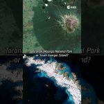
Chiara’s favourite satellite image is a rare (and almost cloud-free) view of the remote Elephant Island, in Antarctica.
This Copernicus Sentinel-2 image was captured a year ago and the full image has a 10 m resolution!
Do you agree with Chiara’s choice?
📸 Italy, South Georgia Island, Elephant Island: contains modified Copernicus Sentinel data (2016, 2018, 2023), processed by ESA, Creative Commons BY-SA 3.0 IGO.
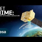
According to the Food and Agriculture Organization (FAO), global agricultural production will need to increase by 60% by 2050 to meet the food demands of the growing global population.
A new satellite called Copernicus Hyperspectral Imaging Mission for the Environment, or CHIME, is being developed to support EU policies on the management of natural resources – ultimately helping to address the global issue of food security.
CHIME will carry a unique visible to shortwave infrared spectrometer to provide routine hyperspectral observations to support new and enhanced services for sustainable agricultural and biodiversity management, as well as soil property characterisation.
CHIME is one of six Copernicus Sentinel Expansion missions that ESA is developing on behalf of the EU. The missions will expand the current capabilities of the Copernicus Space Component – the world’s biggest supplier of Earth observation data.
This video features interviews with Marco Celesti, CHIME Mission Scientist and Jens Nieke, CHIME Project Manager.
Credits: ESA – European Space Agency
★ Subscribe: http://bit.ly/ESAsubscribe and click twice on the bell button to receive our notifications.
We are Europe’s gateway to space. Our mission is to shape the development of Europe’s space capability and ensure that investment in space continues to deliver benefits to the citizens of Europe and the world. Check out https://www.esa.int/ to get up to speed on everything space related.
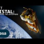
Tracking ice lost from the world’s glaciers, ice sheets and frozen land shows that Earth is losing ice at an accelerating rate. Monitoring the cryosphere is crucial for assessing, predicting and adapting to climate change.
The Copernicus Polar Ice and Snow Topography Altimeter (CRISTAL) mission will provide a full picture of the changes taking place in some of the most inhospitable regions of the world. It will carry – for the first time – a dual-frequency radar altimeter, and microwave radiometer, that will measure and monitor sea-ice thickness, overlying snow depth and ice-sheet elevations.
These data will support maritime operations in the polar oceans and contribute to a better understanding of climate processes. CRISTAL will also support applications related to coastal and inland waters, as well as providing observations of ocean topography.
CRISTAL is one of six Copernicus Sentinel Expansion missions that ESA is developing on behalf of the EU. The missions will expand the current capabilities of the Copernicus Space Component – the world’s biggest supplier of Earth observation data.
This video features interviews with Kristof Gantois, CRISTAL Project Manager and Paolo Cipollini, CRISTAL Mission Scientist.
Credits: ESA – European Space Agency
★ Subscribe: http://bit.ly/ESAsubscribe and click twice on the bell button to receive our notifications.
We are Europe’s gateway to space. Our mission is to shape the development of Europe’s space capability and ensure that investment in space continues to deliver benefits to the citizens of Europe and the world. Check out https://www.esa.int/ to get up to speed on everything space related.
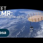
The Arctic is experiencing disproportionately higher temperature increases compared to the rest of the planet, triggering a series of cascading effects. This rapid warming has profound implications for global climate patterns, human populations and wildlife.
The Copernicus Imaging Microwave Radiometer mission (CIMR) will provide measurements to decision makers with evidence of change and impact in the polar regions – with a focus on the Arctic.
The mission has the largest radiometer developed by ESA and will provide high-resolution measurements related to sea ice, the ocean, snow and ice-sheet surfaces. This will be crucial in understanding the evolution of the climate in the polar region.
CIMR is one of six Copernicus Sentinel Expansion missions that ESA is developing on behalf of the EU. The missions will expand the current capabilities of the Copernicus Space Component – the world’s biggest supplier of Earth observation data.
This video features interviews with Craig Donlon, CIMR Mission Scientist, Rolv Midthassel, CIMR Payload Manager, Claudio Galeazzi, CIMR Project Manager, Mariel Triggianese, CIMR Satellite Engineering and AIV Manager, and Marcello Sallusti, CIMR System Performance and Operations Manager.
In the meantime Craig has changed his role but will retain his position as Mission Scientist.
Credits: ESA – European Space Agency
★ Subscribe: http://bit.ly/ESAsubscribe and click twice on the bell button to receive our notifications.
We are Europe’s gateway to space. Our mission is to shape the development of Europe’s space capability and ensure that investment in space continues to deliver benefits to the citizens of Europe and the world. Check out https://www.esa.int/ to get up to speed on everything space related.
25 years ago, Copernicus set out to transform the way we see our planet. It is the largest environmental monitoring programme in the world. Learn more about the Copernicus programme and the Sentinel satellite missions developed by ESA. 👉 https://www.esa.int/Applications/Observing_the_Earth/Copernicus
Credits: ESA
★ Subscribe: http://bit.ly/ESAsubscribe and click twice on the bell button to receive our notifications.
We are Europe’s gateway to space. Our mission is to shape the development of Europe’s space capability and ensure that investment in space continues to deliver benefits to the citizens of Europe and the world. Check out https://www.esa.int/ to get up to speed on everything space related.
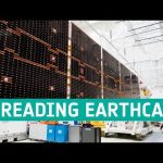
ESA’s EarthCARE satellite mission will soon be launched to answer some critical scientific questions related to the role that clouds and aerosols play in reflecting incident solar radiation back out to space and trapping infrared radiation emitted from Earth’s surface. As engineers are preparing EarthCARE for its life in orbit, the satellite is being put through its paces at ESA testing facilities in the Netherlands – the largest satellite test facility in Europe, equipped to simulate every aspect of the space environment.
One of the first tests involved the deployment of the satellite’s 11 metre solar wing from its folded stowed configuration, which allows it to fit in the rocket fairing, to its fully deployed configuration as it will be in orbit around Earth.
This timelapse video shows this deployment test from various angles.
We are Europe’s gateway to space. Our mission is to shape the development of Europe’s space capability and ensure that investment in space continues to deliver benefits to the citizens of Europe and the world. Check out https://www.esa.int/ to get up to speed on everything space related.
Certamente já usou uma aplicação no telemóvel para consultar a previsão meteorológica. Hoje, graças a uma rede de satélites e estações terrestres, é possível obter informações sobre poluição em várias cidades no seu telemóvel.
O jornalista Claudio Rosmino reporta-nos como a Universidade de Bremen, está a recolher esta variedade de dados para chegar a uma visão global da poluição atmosférica.
A atmosfera terrestre é um sistema complicado que depende de vários factores. Os satélites de observação que orbitam à volta do planeta monitorizam constantemente o estado do ar que inalamos e o modo como é afectado pela poluição natural e pela de origem humana.
Uma missão essencial uma vez que, segundo dados recentes da Organização Mundial de Saúde, uma em cada oito mortes a nível mundial se deve à poluição do ar.
Os investigadores da Universidade de Bremen são pioneiros na medição da poluição atmosférica cruzando os dados obtidos no espaço e os valores colhidos em estações terrestres.
ESA’s new Earth observation satellite Sentinel-3A will soon be launched into orbit. Once more the European Space Agency proves it is on the forefront of monitoring our environment and the climate.
Using state of the art and proven technology the Sentinel-3 satellite is a fabulous piece of engineering set to play a key role in the European Commission’s Copernicus programme. However this technological piece of craftsmanship is only possible as the result of earlier scientific missions such as ERS, Envisat and Cryosat, with Sentinel-3 building on their heritage.