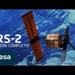
Mission complete. ESA’s second European Remote Sensing (ERS-2) satellite has reentered Earth’s atmosphere over the North Pacific Ocean. The satellite returned at 18:17 CET (17:17 UTC) between Alaska and Hawaii.
ERS-2 was launched almost 30 years ago, on 21 April 1995. Together with ERS-1, it provided invaluable long-term data on Earth’s land surfaces, ocean temperatures, ozone layer and polar ice extent that revolutionised our understanding of the Earth system.
ERS-2’s reentry was ‘natural’. ESA used the last of its fuel, emptied its batteries and lowered the satellite from its altitude of 785 km to 573 km. This reduced the risk of collision with other satellites and space debris. As a result, it was not possible to control ERS-2 at any point during its reentry and the only force driving its descent was unpredictable atmospheric drag.
As well as leaving a remarkable legacy of data that still continue to advance science, this outstanding mission set the stage for many of today’s satellites and ESA’s position at the forefront of Earth observation.
The ERS-2 reentry is part of ESA’s wider efforts to ensure the long-term sustainability of space activities. These include ESA’s Clean Space initiative which promotes the development of new technologies for more sustainable space missions in collaboration with the wider European space community, as well as the Zero Debris Approach, which will even further reduce the debris left in both Earth and lunar orbits by future missions.
Credits: ESA – European Space Agency
★ Subscribe: http://bit.ly/ESAsubscribe and click twice on the bell button to receive our notifications.
Check out our full video catalog: http://bit.ly/SpaceInVideos
Follow us on Twitter: http://bit.ly/ESAonTwitter
On Facebook: http://bit.ly/ESAonFacebook
On Instagram: http://bit.ly/ESAonInstagram
On LinkedIn: https://bit.ly/ESAonLinkedIn
On Pinterest: https://bit.ly/ESAonPinterest
On Flickr: http://bit.ly/ESAonFlickr
We are Europe’s gateway to space. Our mission is to shape the development of Europe’s space capability and ensure that investment in space continues to deliver benefits to the citizens of Europe and the world. Check out https://www.esa.int/ to get up to speed on everything space related.
Copyright information about our videos is available here: https://www.esa.int/ESA_Multimedia/Terms_and_Conditions
#ESA #ERS-2 #Satellite