According to the @worldmetorg, July 2023 is likely to have been the hottest month on record. While much of Europe, North America and Asia suffered the immediate consequences of these brutal temperatures, extreme events are also hitting hard far away in the icy reaches of Antarctica. In a paper published today, scientists highlight Antarctica’s vulnerability to extremes and the role that satellites play in monitoring this remote region.
The Copernicus Sentinel-2 takes us over Malé, the capital and most populous city in the Republic of Maldives, in this edition of the Earth from Space programme.
We are Europe’s gateway to space. Our mission is to shape the development of Europe’s space capability and ensure that investment in space continues to deliver benefits to the citizens of Europe and the world. Check out https://www.esa.int/ to get up to speed on everything space related.
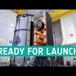
Final preparations are underway in California for the launch of Sentinel-6 Michael Freilich, a joint European and US satellite designed to take precise measurements of sea-level change. The satellite forms part of the European Union’s Copernicus Earth Observation programme and will employ a radar altimeter to map sea-surface topography. The satellite will provide fundamental data for climate science and policymaking, helping to protect the 600 million people who live in vulnerable coastal areas. It will also deliver near-realtime information for marine and weather forecasts.
The mission is a collaboration between ESA, the European Commission, EUMETSAT, NASA and NOAA, with support from the French space agency CNES. Scheduled for launch on 21 November on a SpaceX Falcon 9 rocket from the Vandenberg Air Force Base on the California coast, the satellite is named Michael Freilich after NASA’s former Director of Earth Science.
★ Subscribe: http://bit.ly/ESAsubscribe and click twice on the bell button to receive our notifications.
We are Europe’s gateway to space. Our mission is to shape the development of Europe’s space capability and ensure that investment in space continues to deliver benefits to the citizens of Europe and the world. Check out https://www.esa.int/ to get up to speed on everything space related.
The Copernicus Sentinel-1 mission takes us over Crete, Greece’s largest and most populous island, in this week’s edition of the Earth from Space programme.
We are Europe’s gateway to space. Our mission is to shape the development of Europe’s space capability and ensure that investment in space continues to deliver benefits to the citizens of Europe and the world. Check out http://www.esa.int/ESA to get up to speed on everything space related.
We are Europe’s gateway to space. Our mission is to shape the development of Europe’s space capability and ensure that investment in space continues to deliver benefits to the citizens of Europe and the world. Check out http://www.esa.int/ESA to get up to speed on everything space related.
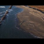
The most recent trends in sea level rise mean the low-lying Camargue region of southern France could be submerged by the sea by the end of the century.
The sea walls built along the coast in the 1980s have already been broken by the waves, as a combination of rising waters, slowly sinking landmass, and reduced amounts of sediment from the Rhone river spell trouble for this environment.
Anis Guelmami uses Copernicus Sentinel satellites to study wetlands like the Camargue, and he tells us the latest news from space.
ESA is Europe’s gateway to space. Our mission is to shape the development of Europe’s space capability and ensure that investment in space continues to deliver benefits to the citizens of Europe and the world. Check out http://www.esa.int/ESA to get up to speed on everything space related.
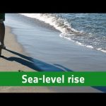
Although it may not be immediately obvious when we visit the beach, sea-level rise is affecting coastlines all over the world. For low-lying countries such as the Netherlands, sea-level rise and tidal surges are a constant threat. Our oceans are rising as a consequence of climate change. As the temperature of seawater increases it expands and the ice melting from ice sheets and glaciers adds more water to the global ocean. We know this because satellites high above our heads measure the temperature of the sea surface and of our changing ice.
While the global averaged trend is towards rising levels, there are many regional differences so that in some places it is rising and in other places it is falling. Satellites carrying altimeter instruments systematically measure the height of the sea surface so that sea-level rise can be closely monitored. Altimetry measurements over the last 25 years show that on average sea-level is rising about 3 mm a year and this rise is accelerating.
ESA is Europe’s gateway to space. Our mission is to shape the development of Europe’s space capability and ensure that investment in space continues to deliver benefits to the citizens of Europe and the world. Check out http://www.esa.int/ESA to get up to speed on everything space related.
Discover more about our planet with the Earth from Space video programme. In this special edition, senior scientist at France’s Collecte Localisation Satellites, Marie-Hélène Rio, joins the show to discuss how data on ocean surface currents by the Sentinel-3 satellite mission are used by people working at sea.
The physical processes causing global sea-level rise are highlighted in the animation. The main causes are thermal expansion of oceans, as they accumulate the excess heat caused by greenhouse gas emissions, the melting of ice from the ice sheets and glaciers, as well as changes in land water storage such as lakes. Regionally, sea level changes vary quite dramatically. The reasons for this are different to the global causes of sea-level changes and include changes to sea water density, influenced by salinity and temperature.
We have all heard of climate change, but what’s really happening to our planet now, in November 2015? As the COP21 summit in Paris looms in December, we set out to establish some of the scientific fundamentals, and hear how space technology is being used to get a truly global view of Earth’s vital signs.
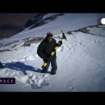
Near Les Deux Alps in the French Alps, some 3,200 metres above sea level, we look at how satellite data and glacier measurements can help us to understand the effects of global warming with remote sensing scientist Jean-Pierre Dedieu.