Live views from the International Space Station are streaming from an external camera mounted on the station’s Harmony module.
The camera is looking forward at an angle so that International Docking Adapter 2 is visible. If the Harmony module camera is not available due to operational considerations for a longer period of time, a continuous loop of recorded Earth views will be displayed with the caption “Previously Recorded.”
The space station orbits Earth about 250 miles (425 kilometers) above the surface. An international partnership of five space agencies from 15 countries operates the station, and it has been continuously occupied since November 2000. It’s a microgravity laboratory where science, research, and human innovation make way for new technologies and research breakthroughs not possible on Earth. More: https://go.nasa.gov/3CkVtC8
Did you know you can spot the station without a telescope? It looks like a fast-moving star, but you have to know when to look up. Download our mobile app for alerts to let you know when (and where) to spot the station and wave to the crew: https://www.nasa.gov/spot-the-station/
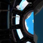
View of Earth as seen by ESA project astronaut Sławosz Uznański-Wiśniewski inside the seven-windowed cupola, the International Space Station’s “window to the world”.
The European Space Agency-built Cupola is the favourite place of many astronauts on the International Space Station. It serves not only as a unique photo spot, but also for observing robotic activities of the Canadian Space Agency’s robotic arm Canadarm2, arriving spacecraft and spacewalks.
Sławosz was launched to the International Space Station on the Dragon spacecraft as part of Axiom Mission 4 on 25 June 2025. The 20-day mission on board is known as Ignis.
During the Ignis mission, Sławosz conducted 13 experiments proposed by Polish companies and institutions and developed in collaboration with ESA, along with three additional ESA-led experiments. These covered a broad range of areas including human research, materials science, biology, biotechnology and technology demonstrations.
The Ax-4 mission marks the second commercial human spaceflight for an ESA project astronaut. Ignis was sponsored by the Polish government and supported by ESA, the Polish Ministry of Economic Development and Technology (MRiT) and the Polish Space Agency (POLSA).
📹 European Space Agency (ESA) 📸 ESA – Sławosz Uznański-Wiśniewski
Live views from the International Space Station are streaming from an external camera mounted on the station’s Harmony module.
The camera is looking forward at an angle so that International Docking Adapter 2 is visible. If the Harmony module camera is not available due to operational considerations for a longer period of time, a continuous loop of recorded Earth views will be displayed with the caption “Previously Recorded.”
The space station orbits Earth about 250 miles (425 kilometers) above the surface. An international partnership of five space agencies from 15 countries operates the station, and it has been continuously occupied since November 2000. It’s a microgravity laboratory where science, research, and human innovation make way for new technologies and research breakthroughs not possible on Earth. More: https://go.nasa.gov/3CkVtC8
Did you know you can spot the station without a telescope? It looks like a fast-moving star, but you have to know when to look up. Sign up for text messages or email alerts to let you know when (and where) to spot the station and wave to the crew: https://spotthestation.nasa.gov
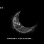
BepiColombo flew past Mercury for the fifth time on 1 December 2024.
During this flyby, BepiColombo gathered more data on the mysterious planet and its surroundings. Aside from taking some ‘regular’ photos of the planet and measuring particles and electromagnetic fields in the space around it, this flyby was the first time that any spacecraft imaged Mercury in mid-infrared wavelengths of light.
BepiColombo will pass much closer to Mercury’s north pole during its final flyby of Mercury on 8 January 2025, its last visit before arriving to enter orbit about the planet in November 2026.
📹 ESA – European Space Agency 📸 MERTIS/DLR/University of Münster & NASA/Johns Hopkins University Applied Physics Laboratory/Carnegie Institution of Washington
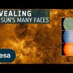
Join us on a unique video tour of the Sun’s mesmerising surface. Thanks to its innovative instrumentation and a ‘daring’ trajectory passing close to the Sun, ESA’s Solar Orbiter spacecraft has obtained the highest-resolution full views of the Sun’s surface to date.
Watching the Sun in visible light, Solar Orbiter reveals a grainy surface and dark sunspots. On the same day, the spacecraft mapped the Sun’s magnetic field, tracked how fast and in which direction scorching hot material on the surface is moving, and snapped a hypnotising image in ultraviolet light of the Sun’s upper atmosphere, the corona. All taken on the same day, the four new images shown in this video let us peel away the Sun’s many layers.
The images were taken when Solar Orbiter was less than 74 million kilometres from the Sun; being so close meant each high-resolution image only covers a small portion of the Sun. To obtain the full-disc views showcased in the video, 25 images were stitched together like a mosaic. The Sun has a diameter of around 8000 pixels in the full mosaics, revealing an extraordinary amount of detail.
Credit: ESA – European Space Agency Acknowledgements: Sun images: ESA & NASA/Solar Orbiter/PHI and EUI Teams; Solar Orbiter spacecraft animation: ESA/ATG medialab; Voiceover: Juliet Hannay
★ Subscribe: http://bit.ly/ESAsubscribe and click twice on the bell button to receive our notifications.
We are Europe’s gateway to space. Our mission is to shape the development of Europe’s space capability and ensure that investment in space continues to deliver benefits to the citizens of Europe and the world. Check out https://www.esa.int/ to get up to speed on everything space related.
Live views from the International Space Station are streaming from an external camera mounted on the station’s Harmony module.
The camera is looking forward at an angle so that International Docking Adapter 2 is visible. If the Harmony module camera is not available due to operational considerations for a longer period of time, a continuous loop of recorded Earth views will be displayed with the caption “Previously Recorded.”
The space station orbits Earth about 250 miles (425 kilometers) above the surface. An international partnership of five space agencies from 15 countries operates the station, and it has been continuously occupied since November 2000. It’s a microgravity laboratory where science, research, and human innovation make way for new technologies and research breakthroughs not possible on Earth. More: https://go.nasa.gov/3CkVtC8
Did you know you can spot the station without a telescope? It looks like a fast-moving star, but you have to know when to look up. Sign up for text messages or email alerts to let you know when (and where) to spot the station and wave to the crew: https://spotthestation.nasa.gov
Join ESA project astronaut Marcus Wandt inside the seven-windowed cupola, the International Space Station’s “window to the world”.
The ESA – European Space Agency-built Cupola is the favourite place of many astronauts on the International Space Station. It serves not only as a unique photo spot, but also for observing robotic activities of the Canadian Space Agency’s robotic arm Canadarm2, arriving spacecraft and spacewalks.
Marcus was launched to the International Space Station on the Dragon spacecraft as part of Axiom Mission 3 on 18 January 2024. His two-week mission on board is known as Muninn.
Live views from the International Space Station are streaming from an external camera mounted on the station’s Harmony module.
The camera is looking forward at an angle so that International Docking Adapter 2 is visible. If the Harmony module camera is not available due to operational considerations for a longer period of time, a continuous loop of recorded Earth views will be displayed with the caption “Previously Recorded.”
The space station orbits Earth about 250 miles (425 kilometers) above the surface. An international partnership of five space agencies from 15 countries operates the station, and it has been continuously occupied since November 2000. It’s a microgravity laboratory where science, research, and human innovation make way for new technologies and research breakthroughs not possible on Earth. More: https://go.nasa.gov/3CkVtC8
Did you know you can spot the station without a telescope? It looks like a fast-moving star, but you have to know when to look up. Sign up for text messages or email alerts to let you know when (and where) to spot the station and wave to the crew: https://spotthestation.nasa.gov
Today, ESA’s Euclid space mission reveals its first full-colour images of the cosmos. Never before has a telescope been able to create such razor-sharp astronomical images across such a large patch of the sky, and looking so far into the distant Universe. These five images illustrate Euclid’s full potential; they show that the telescope is ready to create the most extensive 3D map of the Universe yet, to uncover some of its hidden secrets.
Credits: ESA/Euclid/Euclid Consortium/NASA, image processing by J.-C. Cuillandre (CEA Paris-Saclay), G. Anselmi, CC BY-SA 3.0 IGO
★ Subscribe: http://bit.ly/ESAsubscribe and click twice on the bell button to receive our notifications.
We are Europe’s gateway to space. Our mission is to shape the development of Europe’s space capability and ensure that investment in space continues to deliver benefits to the citizens of Europe and the world. Check out https://www.esa.int/ to get up to speed on everything space related.
The first image shown in this video is the 2005 Hubble optical wavelength image of the Crab Nebula. This is followed by a new image of the object from the James Webb Space Telescope’s NIRCam (Near-Infrared Camera) and MIRI (Mid-Infrared Instrument) instruments that has revealed new details in infrared light.
In Webb’s infrared observation, a crisp, cage-like structure of fluffy red-orange filaments and knots of dust surround the object’s central area. However, some aspects of the inner workings of the Crab Nebula become more prominent and increase in detail in infrared light. In particular, Webb highlights what is known as synchrotron emission, seen here with a milky smoke-like appearance throughout the majority of the Crab Nebula’s interior.
Credit: NASA, ESA, CSA, STScI, T. Temim (Princeton University), N. Bartmann (ESA/Webb), A. Loll/J. Hester (Arizona State University) Music: Stellardrone – The Night Sky in Motion
Live views from the International Space Station (ISS) are streaming from an external camera mounted on the ISS module called Node 2. Node 2 is located on the forward part of the ISS.
The camera is looking forward at an angle so that the International Docking Adapter 2, or IDA2, is visible. If the Node 2 camera is not available due to operational considerations for a longer period of time, a continuous loop of recorded HD Earth Views imagery will be displayed. The loop will have “Previously Recorded” on the image to distinguish it from the livestream from the Node 2 camera.
The space station orbits Earth about 250 miles (425 kilometers) above the surface. An international partnership of five space agencies from 15 countries operates the station, and it has been continuously occupied since November 2000. It’s a microgravity laboratory where science, research, and human innovation make way for new technologies and research breakthroughs not possible on Earth. More: https://go.nasa.gov/3CkVtC8
Did you know you can spot the station without a telescope? It looks like a fast-moving star, but you have to know when to look up. Sign up for text messages or email alerts to let you know when (and where) to spot the station and wave to the crew: https://spotthestation.nasa.gov
Watch live as the Orion spacecraft, after having launched into space aboard the Space Launch System (SLS) rocket, shares its first Earth views during its outbound coast to the Moon. During Artemis I, Orion will travel 280,000 miles (450,000 km) from Earth and 40,000 miles (64,000 km) beyond the far side of the Moon, carrying science and technology payloads to expand our understanding of lunar science, technology developments, and deep space radiation.
Through Artemis missions, NASA will land the first woman and the first person of color on the Moon, paving the way for a long-term lunar presence and serving as a steppingstone to send astronauts to Mars. We are going.
Watch over one hour of our planet, seen from the International Space Station, in 4K resolution. This compilation was made from video taken by ESA astronauts, mostly by Thomas Pesquet during his first mission, Proxima, and ESA astronaut Alexander Gerst on his second mission, Horizons, as well as footage from Samantha Cristoforetti’s Futura mission and Paolo Nespoli’s Vita mission.
Flying 400 km above our amazing planet Earth, the Space Station travels at 28 800 km/h to stay in orbit. The videos are in real time and not sped up or edited. Most of the scenes were filmed in the European-built Cupola module, the Space Station’s observatory.
On 21 April 2001, the first ESA astronaut Umberto Guidoni arrived at the Space Station. Since then, the Space Station has grown immensely, as have the number of Europeans to have worked in it, together with the science experiments performed in orbit.
Europe contributes around 8% of the running costs of the International Space Station, but has built a large part of the structure, including ESA’s Columbus laboratory, the Cupola observatory, the Tranquillity and Harmony modules, as well as the computers that collect data and provide navigation, communications and operations for the Russian segment.
ESA also provided the Space Station with supplies and boosted its orbit through five Automated Transfer Vehicles, the heaviest and most versatile Space Station supply ferry. This programme evolved into the European Service Modules that ESA is supplying for @NASA’s Artemis programme, taking humans forward to the Moon and thus continuing the exemplary international collaboration beyond Earth’s orbit.
Since Umberto’s mission, there have been 26 further ESA astronaut missions to the International Space Station, with astronauts flying to Station on either the Russian Soyuz or US Space Shuttle spacecraft.
Thomas Pesquet’s second mission, Alpha, is the 28th mission for ESA, with ESA astronaut Matthias Maurer already lined up for his first flight later this year, and ESA astronaut Samantha Cristoforetti scheduled for the 30th ESA International Space Station mission in 2022.
★ Subscribe: http://bit.ly/ESAsubscribe and click twice on the bell button to receive our notifications.
We are Europe’s gateway to space. Our mission is to shape the development of Europe’s space capability and ensure that investment in space continues to deliver benefits to the citizens of Europe and the world. Check out https://www.esa.int/ to get up to speed on everything space related.
While in orbit, NASA astronauts Robert Behnken and Douglas Hurley captured stunning views of our home planet Earth.
The duo made history May 30 when they launched from American soil in a commercially built and operated American crew spacecraft to the International Space Station. Their mission and test flight is helping NASA certify SpaceX’s crew transportation system for regular flights carrying astronauts to and from the orbiting laboratory.
Earth observation satellites are guardians of our planet. Thanks to remote sensing technology and daily data collection, researchers are able to better monitor our planet’s oceans and rising sea levels from space. ESA senior advisor for Earth Observation programmes Jérôme Beneviste explains how ocean views from space play a role in climate change studies and natural catastrophe predictions.
We are Europe’s gateway to space. Our mission is to shape the development of Europe’s space capability and ensure that investment in space continues to deliver benefits to the citizens of Europe and the world. Check out http://www.esa.int/ESA to get up to speed on everything space related.
Currently, live views from the International Space Station (ISS) are streaming from an external camera mounted on the ISS module called Node 2. Node 2 is located on the forward part of the ISS. The camera is looking forward at an angle so that the International Docking Adapter 2 (IDA2) is visible. If the Node 2 camera is not available due to operational considerations for a longer period of time, a continuous loop of recorded HDEV imagery will be displayed. The loop will have “Previously Recorded” on the image to distinguish it from the live stream from the Node 2 camera. After HDEV stopped sending any data on July 18, 2019, it was declared, on August 22, 2019, to have reached its end of life.
Thank you to all who shared in experiencing and using the HDEV views of Earth from the ISS to make HDEV so much more than a Technology Demonstration Payload!
The High Definition Earth-Viewing (HDEV) experiment on the International Space Station has experienced a loss of data, and ground computers are no longer receiving communications from the payload. A team of engineers are reviewing the available health and status information from HDEV to identify what may have occurred. Additional updates will be published as they become available.
This video uses data gathered from the Lunar Reconnaissance Orbiter spacecraft to recreate some of the stunning views of the Moon that the Apollo 13 astronauts saw on their perilous journey around the farside in 1970. These visualizations, in 4K resolution, depict many different views of the lunar surface, starting with earthset and sunrise and concluding with the time Apollo 13 reestablished radio contact with Mission Control. Also depicted is the path of the free return trajectory around the Moon, and a continuous view of the Moon throughout that path. All views have been sped up for timing purposes — they are not shown in “real-time.”
Credits:
Data Visualization by: Ernie Wright (USRA)
Video Produced & Edited by: David Ladd (USRA)
Music provided by Universal Production Music: “Visions of Grandeur” – Frederick Wiedmann
This video is public domain and along with other supporting visualizations can be downloaded from the Scientific Visualization Studio at: http://svs.gsfc.nasa.gov/13537
The High Definition Earth-Viewing (HDEV) experiment on the International Space Station has experienced a loss of data, and ground computers are no longer receiving communications from the payload. A team of engineers are reviewing the available health and status information from HDEV to identify what may have occurred. Additional updates will be published as they become available.
The High Definition Earth-Viewing (HDEV) experiment on the International Space Station has experienced a loss of data, and ground computers are no longer receiving communications from the payload. A team of engineers are reviewing the available health and status information from HDEV to identify what may have occurred. Additional updates will be published as they become available.
Cameras outside the International Space Station captured views at 8:10 a.m. Eastern time September 6 of a weakening Hurricane Dorian from 260 miles in altitude as it churned just off the outer banks of North Carolina. In its 8 a.m. EDT advisory, the National Hurricane Center said category 1 Hurricane Dorian is moving toward the northeast near 14 mph with maximum sustained winds of 90 miles an hour. The general motion of Dorian, with an increase in forward speed, is expected through Saturday. On the forecast track, the center of Dorian will move near or over the coast of North Carolina during the next several hours. The center should move to the southeast of extreme southeastern New England tonight and Saturday morning, and then across Nova Scotia late Saturday or Saturday night.
Dorian should remain a potent hurricane as it moves near or along the coast of North Carolina during the next several hours. Dorian is forecast to become a post-tropical cyclone with hurricane-force winds by Saturday night as it approaches Nova Scotia. Hurricane-force winds extend outward up to 45 miles from the center of the system and tropical-storm-force winds extend outward up to 220 miles.
Cameras outside the International Space Station captured views at 11:27 a.m. EDT on Sept. 2 of Hurricane Dorian from 260 miles in altitude as it churned over northwestern Bahamas. In its 11:00 a.m. EDT advisory, the National Hurricane Center said Dorian was almost stationary, moving toward the west at just 1 mile an hour just over 100 miles east of West Palm Beach, Florida, packing catastrophic sustained winds of 155 miles an hour. A slow westward to west-northwestward motion is forecast during the next day or so, followed by a gradual turn toward the northwest and north. On this track, the core of extremely dangerous Hurricane Dorian will continue to pound Grand Bahama Island through much of today and tonight. The hurricane will move dangerously close to the east coast of Florida tonight through Wednesday evening and dangerously close to the Georgia and South Carolina coasts Wednesday night and Thursday. Currently, Dorian is a category 4 hurricane on the Saffir-Simpson Hurricane Wind Scale. Although gradual weakening is forecast, Dorian is expected to remain a powerful hurricane during the next couple of days while moving on a possible track up the southeastern U.S. seaboard.
Cameras outside the International Space Station captured views September 1 of Hurricane Dorian from 260 miles in altitude at 12:16 p.m. Eastern time as it churned over the Atlantic Ocean over the northern Bahamas. The storm, which is moving in a westerly direction with sustained winds of 180 miles an hour, is a dangerous Category 5 hurricane, carrying the strongest winds in recorded history for the northwestern Bahamas. The National Hurricane Center said in its 11 a.m. EDT advisory that Dorian is inflicting catastrophic damage to the Abacos and Grand Bahama Islands. Dorian is forecast to approach the east coast of Florida before taking a possible track up the southeastern U.S. seaboard later this week.
Cameras outside the International Space Station captured views August 30 of rapidly intensifying Hurricane Dorian at 12:18 p.m. Eastern time as it churned over the Atlantic Ocean. The storm, which is moving to the northwest, is forecast by the National Hurricane Center to approach the east coast of Florida Monday evening as a likely category 4 hurricane.