Tag: Sentinel-1A

  • Copernicus: Sentinel services

    Copernicus: Sentinel services

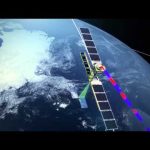
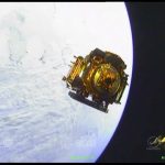
    On 23 June 2015 at 01:52 GMT (03:52 CEST 23 June; 22:52 local time 22 June) Sentinel-2A will launch from Europe’s Spaceport in French Guiana on top of a Vega.

    This satellite will be the second Sentinel for the Copernicus Programme. Copernicus is the most ambitious Earth observation programme to date. It will provide accurate, timely and easily accessible information to improve the management of the environment, understand and mitigate the effects of climate change and ensure civil security.

    This initiative is headed by the European Commission (EC) in partnership with the European Space Agency (ESA). ESA coordinates the delivery of data and is developing a new family of satellites, the Sentinels, specifically for the operational needs of Copernicus. The EC, acting on behalf of the European Union, is responsible for the overall initiative, setting requirements and managing the services. These services fall into six main categories: land management, the marine environment, atmosphere, emergency response, security and climate change.

    This video shows a good example of these services with GeoVille, based in Austria, which is playing a key role in Copernicus services for land applications, related to both land cover production as well as downstream services in the spatial planning domain.

  • Earth from Space: Estonian mosaic

    Earth from Space: Estonian mosaic

    Earth from Space is presented by Kelsea Brennan-Wessels from the ESA Web-TV virtual studios. The one hundred thirty-third edition features a mosaic of Sentinel-1A radar scans, pieced together to create a single image of Estonia.

    See also http://www.esa.int/spaceinimages/Images/2015/02/Estonia to download the image.

  • Earth from Space: Romanian mosaic

    Earth from Space: Romanian mosaic

    Earth from Space is presented by Kelsea Brennan-Wessels from the ESA Web-TV virtual studios. The one hundred twenty-sixth edition features a mosaic of Sentinel-1A radar scans, pieced together to create a single image of Romania.

    See also http://www.esa.int/spaceinimages/Images/2014/12/Romania to download the image.

  • Linking by laser for fast data delivery

    Linking by laser for fast data delivery

    Launched in April 2014, Sentinel-1A carries an advanced radar instrument to image Earth’s surface through cloud and rain, regardless of whether it is day or night. Among its many applications Sentinel-1 routinely monitors shipping zones, maps sea ice and provides information on winds and waves for marine traffic, tracks changes in the way land is being use and provides imagery for rapid response to disasters such as floods, and monitors uplift and subsidence. The satellite transmits data to Earth when passing over ground stations in Norway, Italy and Spain. For continual data delivery, the satellite is also equipped with a laser terminal to transmit data to satellites in geostationary orbit carrying the European Data Relay System (EDRS). These satellites then transmit the Sentinel-1 data to the ground. Complementing the Sentinel ground-station network, EDRS will ensure the timely availability of large volumes of data.

    Currently, a precursor optical communications terminal and downlink system is carried on the geostationary Alphasat, Europe’s largest telecommunications satellite. The first EDRS element will be carried on the Eutelsat-9B satellite, which will be launched in 2015. In the meantime, Sentinel-1A can use the precursor instrument on Alphasat to further improve the availability of its data. Sentinel-2A, scheduled to be launched in the spring of 2015, also carries the same optical communications payload.

  • Earth from Space: Pinatubo

    Earth from Space: Pinatubo

    Earth from Space is presented by Kelsea Brennan-Wessels from the ESA Web-TV virtual studios. This week’s image from the Sentinel-1A radar satellite shows part of the Philippine island of Luzon with Mount Pinatubo.

    See alsohttp://www.esa.int/spaceinimages/Images/2014/07/Mount_Pinatubo_Philippines the image.

  • Onboard camera view: launch and separation of Sentinel-1A

    Onboard camera view: launch and separation of Sentinel-1A

    Cameras mounted on the Soyuz Fregat upper stage that sent Sentinel-1A into space on 3 April 2014 captured this superb footage. It shows liftoff, the various stages in the rocket’s ascent and the Sentinel-1A satellite being released from the Fregat upper stage to start its life in orbit around Earth.

    The 2.3 tonne satellite lifted off on a Soyuz rocket from Europe’s Spaceport in Kourou, French Guiana at 21:02 GMT (23:02 CEST). The first stage separated 118 sec later, followed by the fairing (209 sec), stage 2 (287 sec) and the upper assembly (526 sec). After a 617 sec burn, the Fregat upper stage delivered Sentinel into a Sun-synchronous orbit at 693 km altitude. The satellite separated from the upper stage 23 min 24 sec after liftoff.

    Sentinel-1 is the first in the family of satellites for Europe’s Copernicus programme. It carries an advanced radar to scan Earth’s surface in all weather conditions and regardless of whether it is day or night. This new mission will be used to care for many aspects of our environment, from detecting and tracking oil spills and mapping sea ice to monitoring movement in land surfaces and mapping changes in the way land is used.

  • Sentinel-1A separation in space

    Sentinel-1A separation in space

    This superb footage was acquired by cameras on the Soyuz Fregat upper stage that released Sentinel-1A into orbit on 3 April 2014. It shows the Sentinel-1A satellite separating from the Fregat to start its life in orbit around Earth.

    The 2.3 tonne satellite lifted off on a Soyuz rocket from Europe’s Spaceport in Kourou, French Guiana at 21:02 GMT (23:02 CEST). The first stage separated 118 sec later, followed by the fairing (209 sec), stage 2 (287 sec) and the upper assembly (526 sec). After a 617 sec burn, the Fregat upper stage delivered Sentinel into a Sun-synchronous orbit at 693 km altitude. The satellite separated from the upper stage 23 min 24 sec after liftoff.

    Sentinel-1 is the first in the family of satellites for Europe’s Copernicus programme. It carries an advanced radar to scan Earth’s surface in all weather conditions and regardless of whether it is day or night. This new mission will be used to care for many aspects of our environment, from detecting and tracking oil spills and mapping sea ice to monitoring movement in land surfaces and mapping changes in the way land is used.

    Credits:
    Arianespace/ESA/Roscosmos

  • Sentinel-1: Radar mission

    Sentinel-1: Radar mission

    In early April, Sentinel-1A will be launched from Europe’s Spaceport in French Guiana on a Soyuz launcher. The radar mission is the first of the Copernicus programme, providing an all-weather, day-and-night supply of imagery for Copernicus user services.