Satellite data continues to enable weather forecasters to look inside and outside of powerful hurricanes. Imagery from NOAA’s GOES East satellite, captured Sept. 17 to Sept. 20, shows Hurricane Jose along the U.S. east coast, and Hurricane Maria, as it moved through the Leeward Islands, strengthening to a Category 5 hurricane, and making landfall in Puerto Rico. Meanwhile, The Global Precipitation Measurement (GPM) satellite found rain falling inside Maria at a rate of over 6.44 inches per hour in powerful storms that reached above 9.7 miles high. Also, SpaceX Dragon Returns with Science, Katherine Johnson Research Facility Opened, Earth’s Gravity Assist to OSIRIS-REx, Hubble Spots Asteroids Orbiting Each Other, and Engineering the Future!
This video is available for download from NASA’s Image and Video Library: https://images.nasa.gov/#/details-NHQ_2017_0922_This%20Week%20@NASA.html
Similar Posts:
-
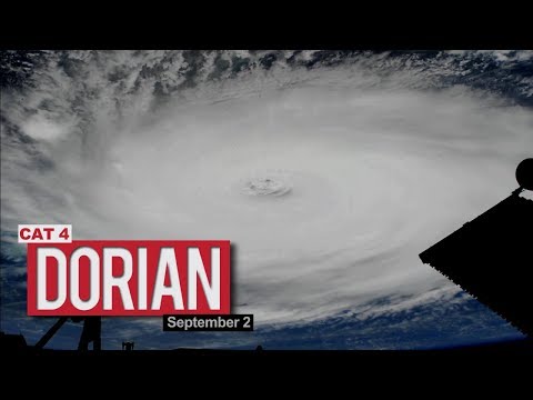
Views of Hurricane Dorian from the International Space Station – September 2, 2019 -
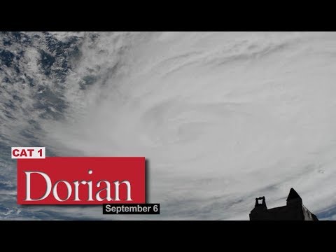
Views of Hurricane Dorian from the International Space Station – September 6, 2019 -

ESA Euronews: The real-life space cadets: Abbie, Marc and Maria -
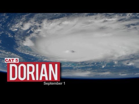
Views of Hurricane Dorian from the International Space Station – September 1, 2019
Leave a Reply