
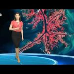
An animation of satellite observations from Oct. 21-30, 2012, shows the birth of Tropical Storm Sandy in the Caribbean Sea, the intensification and movement of Sandy in the Atlantic Ocean along the U.S. East Coast, and the landfall of Hurricane Sandy in New Jersey on Oct. 29. This visualization was created by the NASA GOES Project at NASA Goddard Space Flight Center, Greenbelt, Md., using observations from NOAA’s GOES-13 and GOES-15 satellites.
Tag: satellite
-
Earth from Space: Mississippi River Delta
Earth from Space is presented by Kelsea Brennan-Wessels from the ESA Web-TV virtual studios.
In the twenty-fourth edition we look at the Mississippi River Delta, where the largest river in the United States empties into the Gulf of Mexico. -

ESA Euronews: The mysteries of Mercury
Mercury has always been something of a puzzle for planetary scientists. Its close position to the Sun means it is very difficult to observe, but now a series of satellites is getting up close to this fascinating planet. The European Space Agency’s BepiColombo mission is among them, and it will offer an unprecedented level of information about the mysterious world of Mercury.
-
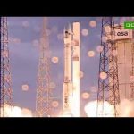
Succès pour le vol inaugural du nouveau lanceur Vega de l’ESA
Vega, le nouveau lanceur de l’ESA, est désormais prêt pour son entrée en exploitation aux côtés d’Ariane-5 et de Soyouz, après le succès de son vol de qualification, effectué ce matin depuis le port spatial de l’Europe à Kourou (Guyane française).
Avec Vega, qui vient compléter la famille des lanceurs disponibles à Kourou, l’Europe est désormais à même de répondre à toute la gamme des besoins de lancement, que ce soit pour mettre sur orbite des petits satellites scientifiques et d’observation de la Terre ou pour entreprendre des missions de vaste envergure comme l’envoi de véhicules ESA de ravitaillement à destination de la Station spatiale internationale (ISS).
Vega a décollé pour la première fois à 10h00 GMT (11h00 heure de Paris, 7h00 heure locale) de son nouveau pas de tir, et son vol de qualification s’est parfaitement déroulé.
-
2012 ESA Missions Preview
This video presents the key events in 2012 for ESA.
André Kuipers continues his PromISSe mission aboard the International Space Station until May, the 4th ESA long duration mission. During his stay the third European ATV cargo ship will bring food and supplies to the orbital outpost. Early in the year the new Vega launcher will make its qualifying flight from Europe’s Spaceport in French Guiana. The end of the year will be marked by an ESA Conference at Ministerial level, a major decision point for the future of Europe in Space.
More backgroud information can be found on: www.esa.int
-
ESA Euronews: Klein aber fein
Sie haben die Größe einer Waschmaschine, doch sie beschaffen wertvolle Informationen bei der Beobachtung der Erde und der Sonne. Die Rede ist von Mikrosatelliten mit dem Namen Proba.
-
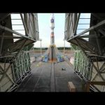
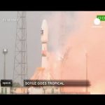
First Soyuz transfer and liftoff from French Guiana
The Russian Soyuz vehicle lifted off for the first time from its new launch complex at Europe’s Spaceport in French Guiana on 21 October 2011. Flight VS01 carried the first two operational satellites of Europe’s Galileo navigation system into orbit.
This time-lapse movie shows the three-stage Soyuz transfer from the assembly and testing building to the launch pad where it is then raised to the vertical. Once in the Mobile gantry, the Upper Composite containing the satellites and Fregat-MT upper stage is hoisted into position on top of the vehicle. The gantry is then rolled back, clearing the way for Soyuz to lift off. -
ESA Euronews: Soyuz descola pela primeira vez do Porto Espacial da Europa
Lançou o Sputnik e Gagarin para o espaço. O mítico foguetão russo Soyuz conta já com mais de 1700 voos. O lançamento do Porto Espacial Europeu, na Guiana Francesa, abre um novo capítulo na sua longa carreira.
-
Galileo — Europe leads the way… in 3D!
A 3D presentation of the Galileo satellite navigation system, a joint development by the European Union and European Space Agency. This constellation of satellites will allow users to pinpoint their location anywhere on Earth — their launches commencing on 20 October 2011.
Use red/blue 3D glasses to experience the full 3D experience of this clip.
-

ESA Euronews: La storia di un satellite
Tutto ha una fine. Per gli uomini ma anche per i satelliti. Dopo sedici anni di fedele servizio, il satellite d’osservazione ERS 2 è condannato a trasformarsi in luce e calore. È l’argomento di questa puntata di Space.
-
ESA Euronews: La Agencia Espacial Europea se despide de una de sus mejores creaciones
Nada dura eternamente. Eso es igual para las personas como para los satélites. Después de 16 años de un precioso y preciso trabajo, el satélite de observación terrestre ERS 2 está condenado a convertirse en polvo y fuego. En Space.
-

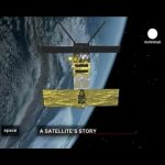
ESA Euronews: A satellite’s story
Everything must come to an end — including satellites. After 16 years of loyal service observing Earth, the ERS-2 satellite has retired.
This edition of Space tells the life story of the venerable satellite. -
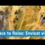
ESA – Space to Relax / Earth view by Envisat
Images in HD quality taken by the optical and radar instruments on board ESA’s Envisat Satellite orbiting 800 km above the Earth are set to relaxing music.
Originally produced for Lufthansa inflight entertainment (released December 2010). -

GOCE: Geoid
Launched on 17 March 2009, ESA’s Gravity field and steady-state Ocean Circulation Explorer (GOCE) is bringing about a whole new level of understanding of one of Earth’s most fundamental forces of nature: the gravity field. Dubbed the ‘Formula 1’ of satellites, GOCE is mapping Earth’s gravity field in unprecedented detail.
This has given rise to a unique model of the ‘geoid’, which is the surface of an hypothetical global ocean in the absence of tides and currents, shaped only by gravity. It is a crucial reference for measuring ocean circulation and sea-level change, which are affected by climate change.
The colours in the image represent deviations in height ( -100 m to + 100 m) from an ideal geoid. The blue colours represent low values and the reds/yellows represent high values.
See also: Earth’s gravity revealed in unprecedented detail at: http://www.esa.int/esaCP/SEM1AK6UPLG_index_0.html
-

ESA Euronews: Navigation by satellite
Today GPS is a common and extremely useful tool. Europeans wanted to refine its accuracy by developing EGNOS, the precursor of the Galileo constellation.
We look at satellite navigation and its applications. -

ESA Euronews: Il satellite al servizio di internet
L’internet ad alta velocità è una necessità. Non importa dove siete, lontano
dalle città o in treno. Potete essere sempre connessi se l’autostrada
dell’informazione attraversa lo spazio. In questa puntata Space si occupa dell’internet satellitare, un modo universale e efficiente per avere accesso al World Wide Web. -

ESA Euronews: Internet de alta velocidad cuando sea y donde sea
Disponer de internet a alta velocidad se ha convertido en una necesidad en cualquier lugar del planeta, ya sea en un pueblo aislado o en un tren. La mejor solución llega desde el espacio: La conexión a internet vía satélite.
-
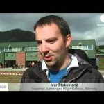
ESA Euronews: A can-size challenge for European students (Español)
Flying your very own rocket with its model satellite – this was the challenge facing high-school students from all over Europe this summer for the first ever European CanSat competition in Norway.
-

ESA Euronews: A can-size challenge for European students (Português)
Flying your very own rocket with its model satellite – this was the challenge facing high-school students from all over Europe this summer for the first ever European CanSat competition in Norway.
-

ESA Euronews: A can-size challenge for European students
Flying your very own rocket with its model satellite – this was the challenge facing high-school students from all over Europe this summer for the first ever European CanSat competition in Norway.
-
ESA Satellite Telecommunications
Global communications underpin modern society and represent an important commercial sector. Satellites are a fundamental part of global telecommunications networks, providing all kind of services, efficiently and seamlessly, over almost every region of our planet.
-
Introducing the GOCE Earth Explorer satellite
To achieve its crucial scientific objectives, ESA’s ‘Gravity field and steady-state Ocean Circulation Explorer’, or GOCE, satellite must orbit as low as possible, in order to sense minute variations in the Earth’s gravitational field – at the edge of space and the limits of the atmosphere at only 268 km!
-
NASA Mission Update: New Horizon
Three billion miles away from Earth, near the farthest reaches of our solar system, is the heavenly body with an extreme orbit known for 76 years as Pluto. Discovered by astronomers in 1930, Pluto was considered the ninth planet in our solar system until 2006 — when, after much debate, it was reclassified by the International Astronomical Union as a “dwarf planet,” officially dropping its name — for a number.
Denis Bogan, New Horizons Program Scientist: “Well, it certainly doesnt affect Pluto. Pluto is the same thing it was before it was discovered, before it was given a name, and before the name was changed.”
Nor does Pluto’s reclassification change the importance of NASA’s first mission to study it.
Launch Announcer: “We have ignition and lift off of NASAs New Horizon spacecraft on a decade-long”
Launched in January 2006, the thousand-pound New Horizons spacecraft will travel through space for 9-1/2 years before meeting up with Pluto in the summer of 2015.
Denis Bogan: “The last time Pluto was in this position in its orbit was during the French and Indian War. It takes 248 Earth years to travel around its orbit and come back to the same place again. At the speed of light, sending a radio signal back from the spacecraft, from Pluto to Earth, will take 4-1/2 hours.”
Operating on less power than a pair of common 100-watt light bulbs, New Horizons will map the highest-interest areas of Pluto to a resolution of 50 meters, less than the length of a football field — three billion miles away. Itll then move on to survey Pluto’s neighborhood: the atmosphere, ancient materials and small bodies of the Kuiper Belt, a chaotic region astrophysicists believe can tell us how Earth, the planets, even our sun were made.
Denis Bogan: “We have primitive material chunks of rock and ice, millions of objects of objects out there in the Kuiper Belt and we know very little about it. We didnt discover it until 1992.”
Traveling 3 billion miles to frozen, rocky Pluto and its environs, New Horizon is, in a way, going back in time to the chemical building blocks of the solar system, and life.
To learn more about the New Horizons mission visit www.nasa.gov
-
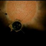
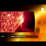
NASA Mission Update: ULYSSES
The sun is the source of life-sustaining energy here on Earth. Much of how it works – and affects us — remains a source of scientific mystery. Sunspots were first recorded by humans in the 16-hundreds. Astrophysicists have since linked heightened sunspot activity with the solar wind. It’s a million-mile-an-hour force of magnetically-charged particles emanating from the sun’s upper atmosphere. Ebbing and flowing in minimum and maximum intensities over eleven year cycles, this so-called space weather can seriously affect how things work here on Earth, such as disrupting satellite communications, telephone service and personal electronics.
Arik Posner, Program Scientist: “It would help our technology, to safeguard the technology by knowing when and in what intensity space weather occurs and where these effects might show up”
Launch Announcer : “2 -1 ignition and liftoff of Discovery and the Ulysses spacecraft bound for the polar regions of the sun.”
Until the launch of Ulysses from space shuttle Discovery in 1990, data for understanding and predicting space weather had come from a limited sampling area: the plane extending from the suns equator. Ulysses has since made three orbits above and below the poles of the sun, vastly expanding the territory from where raw space weather data are gathered.
Arik Posner: “So Ulysses was really the first spacecraft that leaped out of this confinement, and it gives us a view of the global heliosphere.”
Ulysses has found that the solar minimum were in right now is producing the lowest levels of solar wind seen since accurate readings became available a half-century ago. But for heliophysicists, these data raise as many questions as they answer.
Arik Posner: “The Space Age is only 50 years now, and the Sun just operates on longer time scales than these 50 years. So we might have just glimpsed just the surface of what is really going on.”
By expanding its reach, both in time and space, Ulysses is helping the discipline of space weather prediction grow beyond its infancy for the betterment of life here on Earth.
For more about Ulysses, the heliosphere, and space weather, log onto: www.nasa.gov/missions and click on ‘Ulysses.’
-
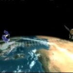
NASA Mission Update: CALIPSO
NASA Mission Update: CALIPSO
Clouds have forever held the imagination of skygazers who are captivated by their endless beauty and seeming randomness. But clouds, and whats in them, also hold fascination for scientists who seek to understand the many effects they have on life here on Earth.
Hal Maring, Program Scientist, CALIPSO: “Low clouds, which are white, can reflect sunlight and cause cooling of the Earth, and high clouds tend to warm the Earth by absorbing and re-radiating warmth back into the atmosphere.”
Launch Announcer: “2-1 We have ignition and we have lift-off of NASAs Calipso/Cloudsat spacecraft.”
Since its launch in April 2006, the Cloud-Aerosol Lidar and Infrared Pathfinder Satellite Observation mission, CALIPSO, has provided new insight into the role that clouds play in regulating our climate. As CALIPSO orbits the Earth, its light detection and ranging, or lidar system, emits short pulses of green and infrared light, producing a 300-feet wide snapshot of what’s in the atmosphere from top to bottom — clouds and airborne particles. Snapshots collected along the same orbit are then streamed together to paint a picture of what a vertical slice of our atmosphere looks like.
Hal Maring: “Its basically a large laser range finder, and it shoots light down into the atmosphere. And, its able to detect and measure, clouds in the vertical .Not like a photograph, which tends to be two-dimensional, but gives us vertical curtains of measurements of clouds, i.e., their altitude.”
These critical cloud data from CALIPSO are used with information gathered by other satellites in NASAs A-train constellation of Earth-observing spacecraft to quantify just how much sunlight reaches the planet — and how much gets radiated back into space. This so-called energy budget is a key to documenting and understanding climate change.
Hal Maring: “We have found, it appears as though, the Earth is warming and its warming because of an imbalance or a change in the Earths energy budget.”
To see and learn more about CALIPSOs cloud images, or how CALIPSOs also helping scientists understand how climate may be changed by naturally-occurring and manmade particulates in the atmosphere called aerosols, go to www.nasa.gov/missions and click on “CALIPSO.”