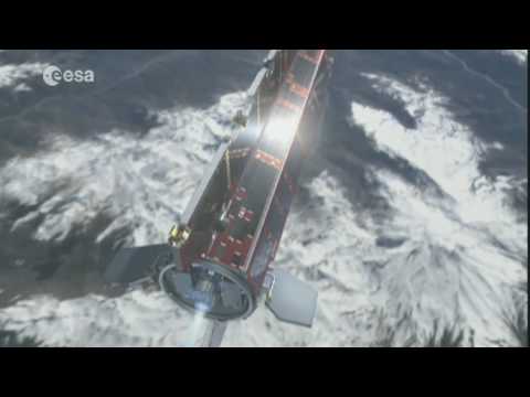
Launched on 17 March 2009, ESA’s Gravity field and steady-state Ocean Circulation Explorer (GOCE) is bringing about a whole new level of understanding of one of Earth’s most fundamental forces of nature: the gravity field. Dubbed the ‘Formula 1’ of satellites, GOCE is mapping Earth’s gravity field in unprecedented detail.
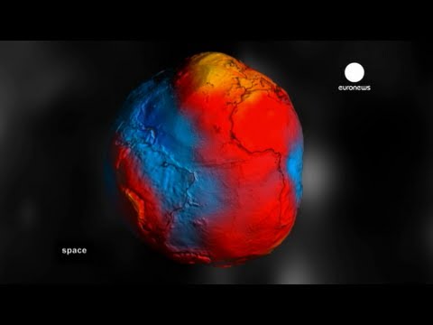
This has given rise to a unique model of the ‘geoid’, which is the surface of an hypothetical global ocean in the absence of tides and currents, shaped only by gravity. It is a crucial reference for measuring ocean circulation and sea-level change, which are affected by climate change.
The colours in the image represent deviations in height ( -100 m to + 100 m) from an ideal geoid. The blue colours represent low values and the reds/yellows represent high values.
See also: Earth’s gravity revealed in unprecedented detail at: http://www.esa.int/esaCP/SEM1AK6UPLG_index_0.html


Leave a Reply